
Kansas is located in what is known as "tornado alley." To most, this is a daunting phrase, where perhaps the Wizard of Oz-esque storms comes to mind. To those of us who have lived in tornado alley, the storms, although treacherous at times, brings peace to the prairie. To someone who hasn't experienced a supercell rolling across the prairie, the majesty of it is difficult to describe. There's a certain electricity in the air that cannot be put into words, but can only be felt. The wind shifts, the air feels thicker, and the mood changes. The wilderness becomes aware of the storm.
The sage brush on the Kansas prairie glows with the light of the sunset as a storm departs at highway speeds.
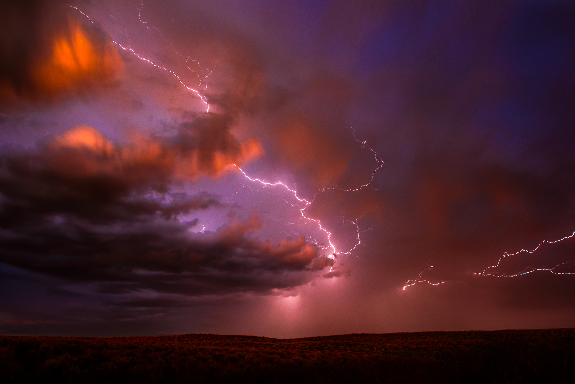
It's almost as if the wildlife disappear. At the first sound of thunder, there's not a breath of wind and not another sound to be heard as all the surrounding energy is funneled into the storm. As the storm looms closer, you can sometimes see what's known as a shelf cloud, which is a large pattern of high winds, sometimes exceeding 70-80 miles per hour. When the shelf cloud hits, all hell breaks loose. The storm erupts in a fury of wind, rain, and lightning almost as if out of nowhere.
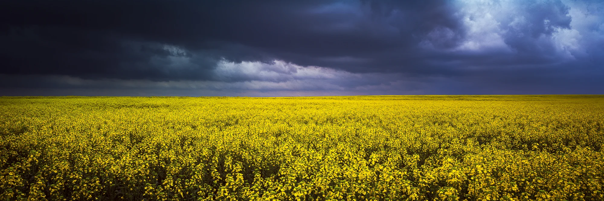
A field of canola awaits a looming storm in eastern Kansas.
The storm can rage anywhere from a few minutes to an hour, but it always seemed like the shorter, the stronger they were. Super cells are common during the spring. They are essentially incredibly severe storm pods that pop up along frontal boundaries. These small, but intense storms are usually the ones I seek as a photographer. They allow you to get close to the action with sometimes incredible light. Most of the images you'll see in this post were taken of super cell thunderstorms within an hour of sunset, where the sun can pass into the center of the storm.
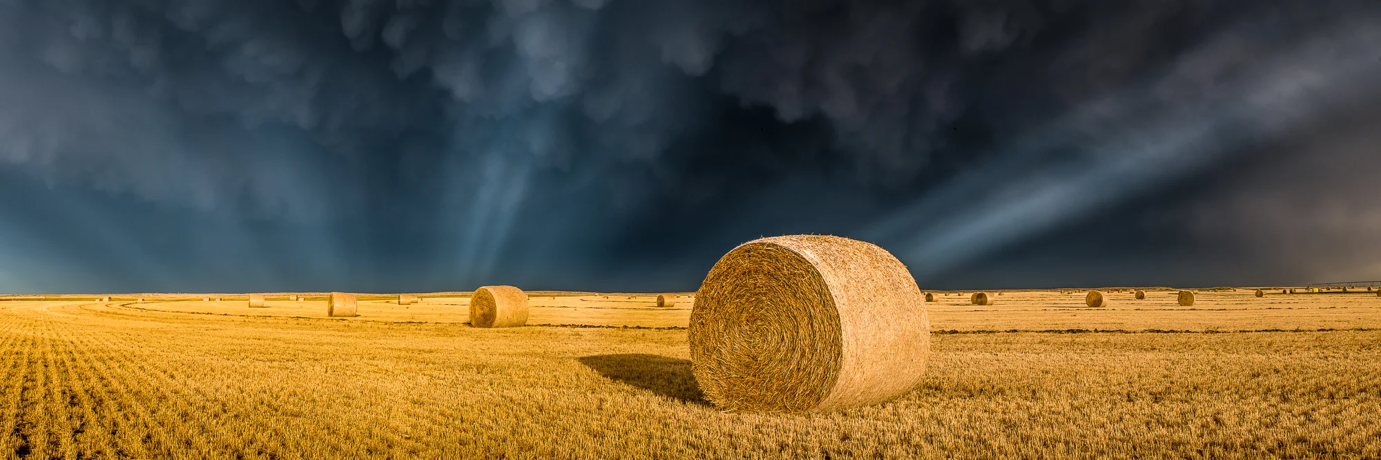
Crepuscular rays shine underneath strong mammatus cloud formations over a hay field on the Kansas prairie.
When the sun does pass into the storm, magical light happens. If this does happen while I'm in position to photograph it, this is usually about the time where I begin to panic in excitement. The image above is one of my favorites I've ever taken...it's like the stars aligned perfectly that afternoon. The puffy spherical-like clouds are formations called mammatus clouds. They're often associated with severe thunderstorms and can be found under the base of the cumulonimbus cloud structure (or anvil cloud), which are the typical thunderstorm clouds you see stretching high into the atmosphere. As I had taken a few exposures of the mammatus clouds themselves, the storm itself somewhat passed in front of the sun, which caused these beams of light, known as crepuscular rays to shine into the depth of the storm. To this day, they are the most pronounced crepuscular rays I have ever seen.
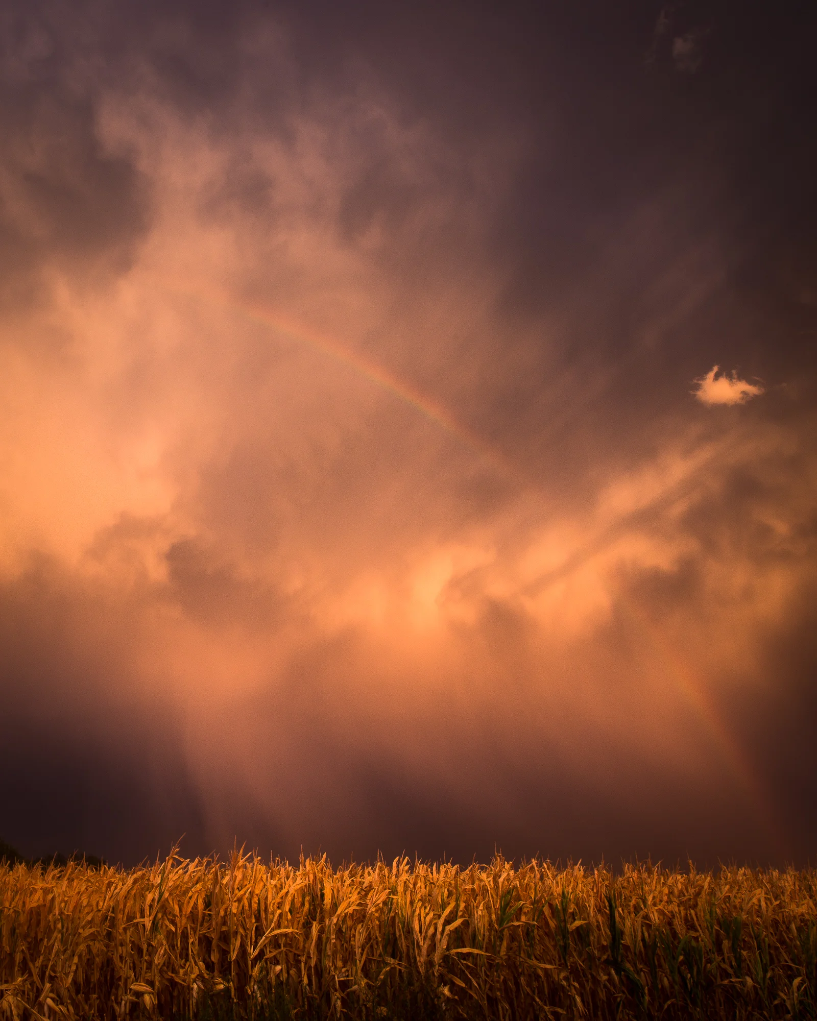
A rainbow appears after a storm passes in eastern Kansas.
Tomorrow, I head back to Kansas for the weekend to see my family. It's been a long time since I've seen any substantial rain and it's been well over a year since I've even seen lightning, so I'm hoping the storms in the Kansas prairie will fire up just for me. To those of you who live in Kansas or anywhere in tornado alley, stay safe this year and keep an eye on the skies.
If you like hearing stories behind my photos, please feel free to share my blog posts with your family and friends on social media or through email by following the "share" button below.
I recently purchased an 8x10 camera and from here on out, every photograph you see on this website will be $50 out of my pocket, just in the cost of the film / develop / scan. If you like seeing my photographs and reading the stories behind them, please feel free to donate.